Original, layered wall art crafted in wood and designed to be personal.

PEORIA | CHICAGO | MIDWEST

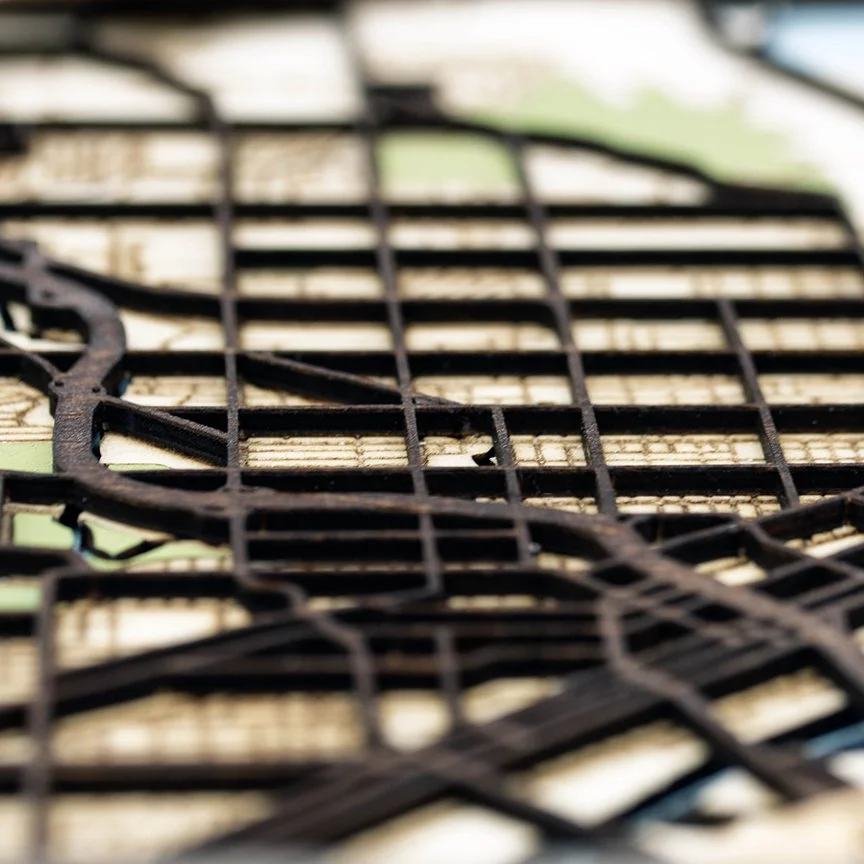
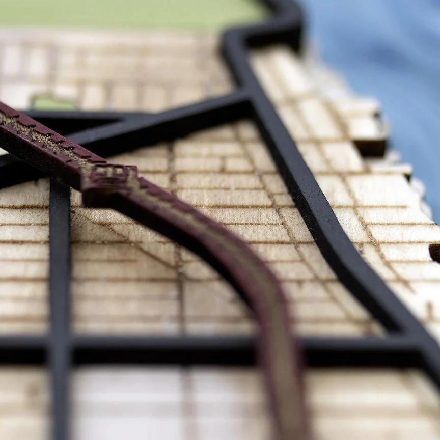
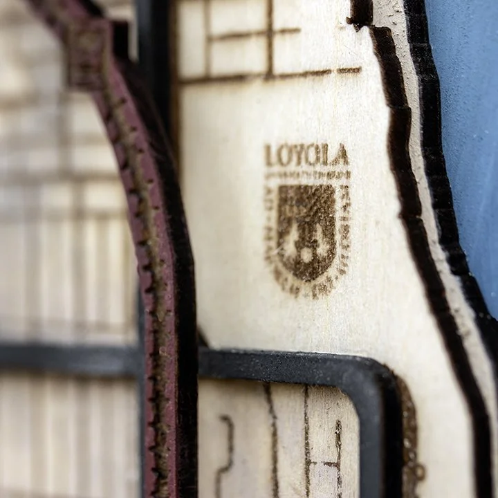
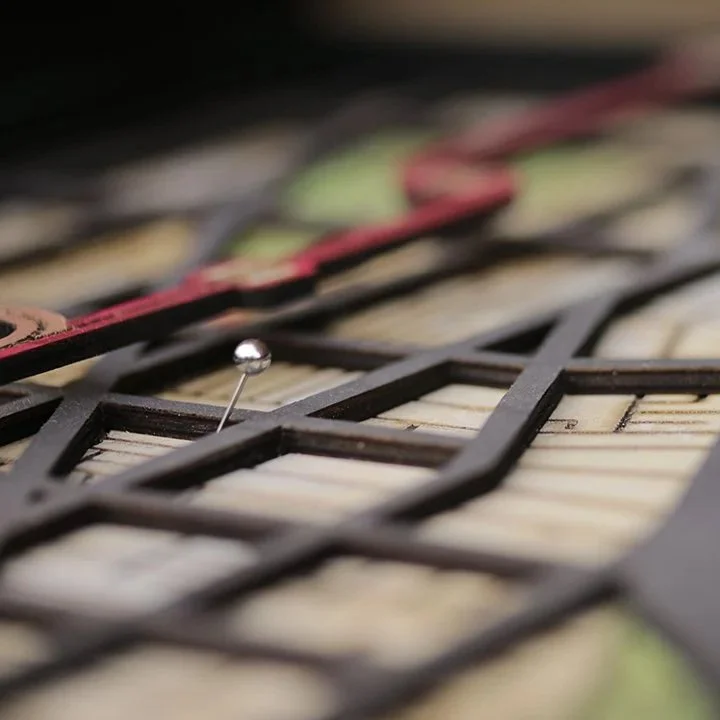
We design each piece in 3D and assemble it by hand—layer by layer—for a sculptural look you can see and feel. Personalize with names, dates, or coordinates to mark the places that matter most.

Framed wooden map of Peoria, Illinois, with streets, parks, and rivers, with labels "Greetings from PEORIA Illinois" and "EST. 1831."
Decorative framed map of Peoria, Illinois with streets, river, and green park areas.

Peoria, Illinois

Close-up of 3D handmade map of Peoria, Illinois.
Close-up of GPS Coordinates as an example of customization available.

Layered 3D Wood Map of Peoria | Customizable, Framed, and Ready to Hang | $149

Features the L Red Line Train, Montrose Beach, and Lake Michigan.

3D Map of Uptown Neighborhood, Chicago, showing streets, parks, and Lake Michigan with a compass rose in the lower right corner.

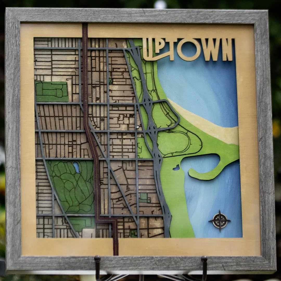
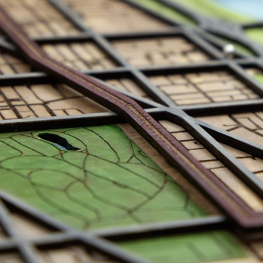
Uptown, Chicago Illinois

Close-up of the Uptown neighborhood logo on a 3D Chicago map.
Close-up of the Red Line L track running past Graceland Cemetery.

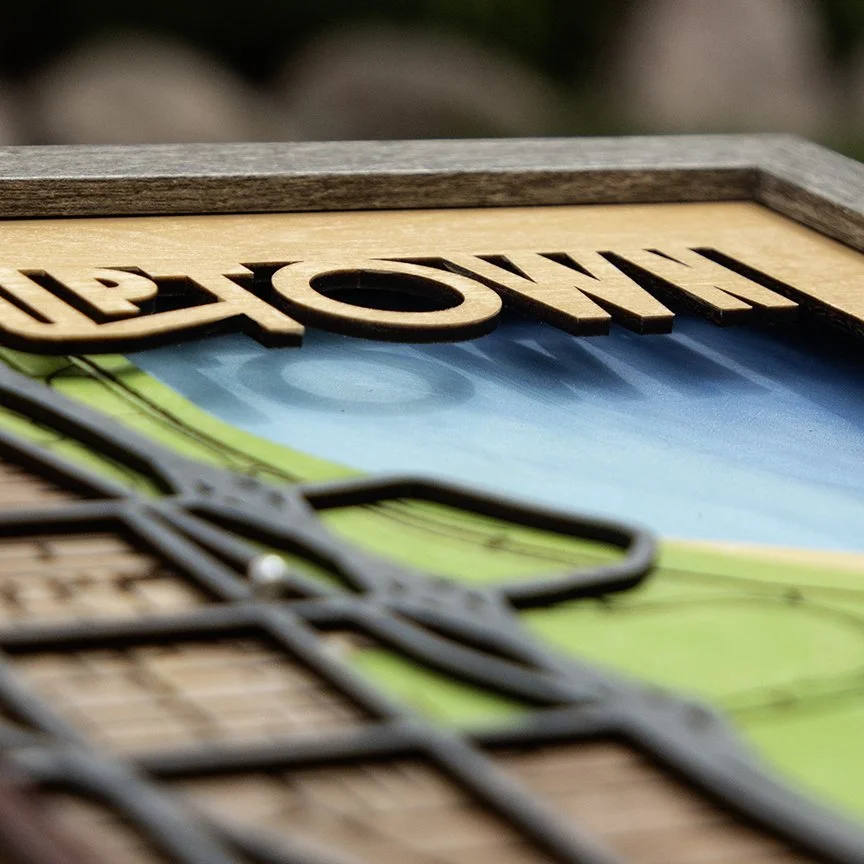
Layered 3D Wood Map of Uptown, Chicago | Customizable, Framed, and Ready to Hang | 12x12”? | $149

Features the L Red Line Train, Montrose Beach, and Lake Michigan.

Rogers Park, Chicago Illinois

A stylized map of Rogers Park neighborhood with streets, parks, and Lake Michigan shoreline, including a circular emblem of Rogers Park at the top right.
Close-up of Chicago neighborhood streets, raised highways and the Red Line L track along the North Shore.
Close-up of layered wooden pieces with a laser-etched logo of Loyola Chicago University along Lake Michigan and the Red Line L Track

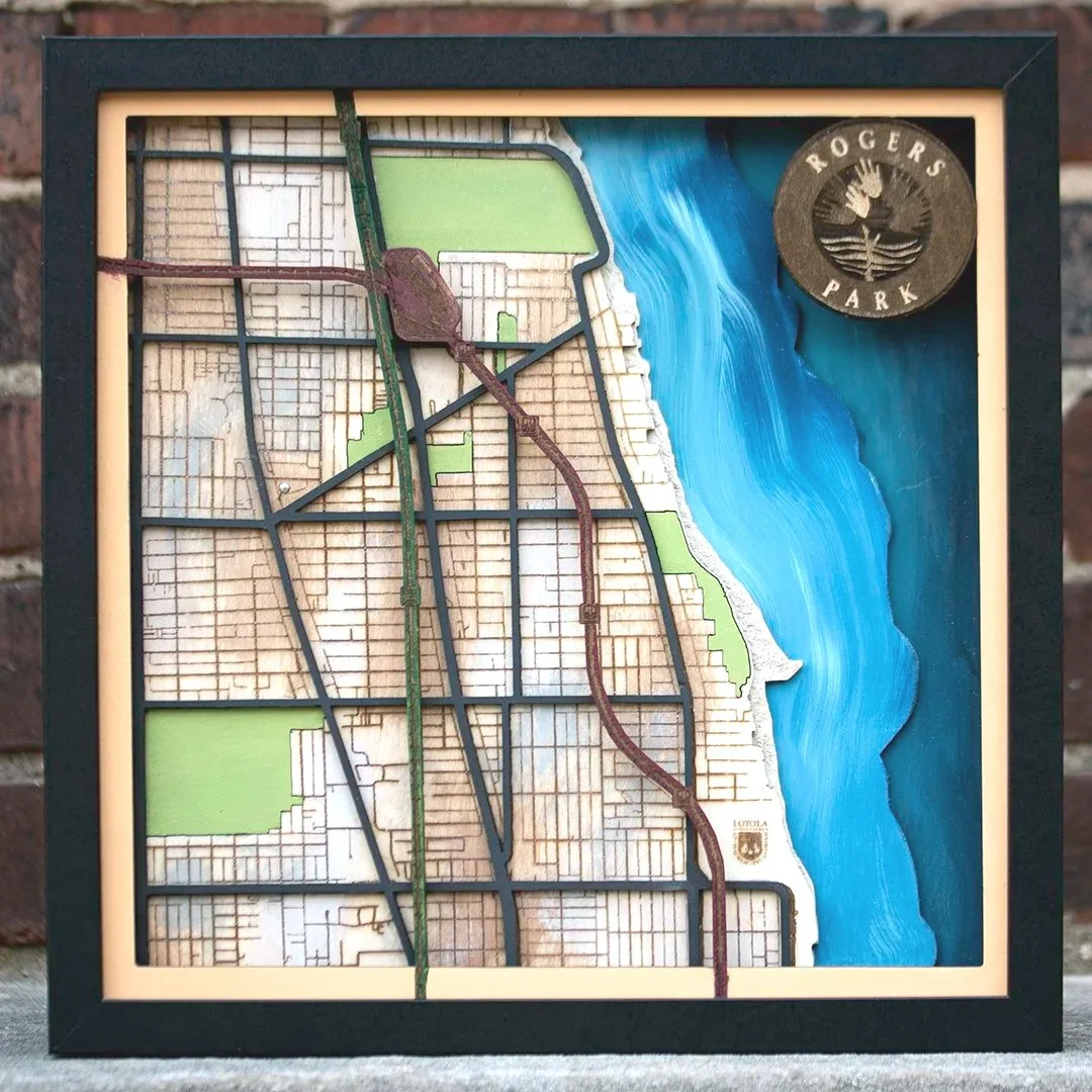
Layered 3D Wood Map of Rogers Park, Chicago | Customizable, Framed, and Ready to Hang | 12x12”? | $149

Features the L Red Line Train, Lake Michigan, neighborhood streets, and green spaces

Lakeview East, Chicago

Map of Lakeview East, established in 1857, showing streets, Lake Michigan on the right, green parks, and raised red and brown L track transit routes.
Close-up of the North Shore of Chicago Red and Brown L Train Lines with a push pin marking the location of your favorite restaurant and coffee house.
Close-up of a 3D wooden map with a wedding anniversary date cut into the frame.
Close-up of Wrigleyville, neighborhood streets, major thoroughfares, and the Red and Brown Elevated Rail Tracks or Chicago
Close-up of Chicago neighborhood streets and transportation. A push pin marks a special place.

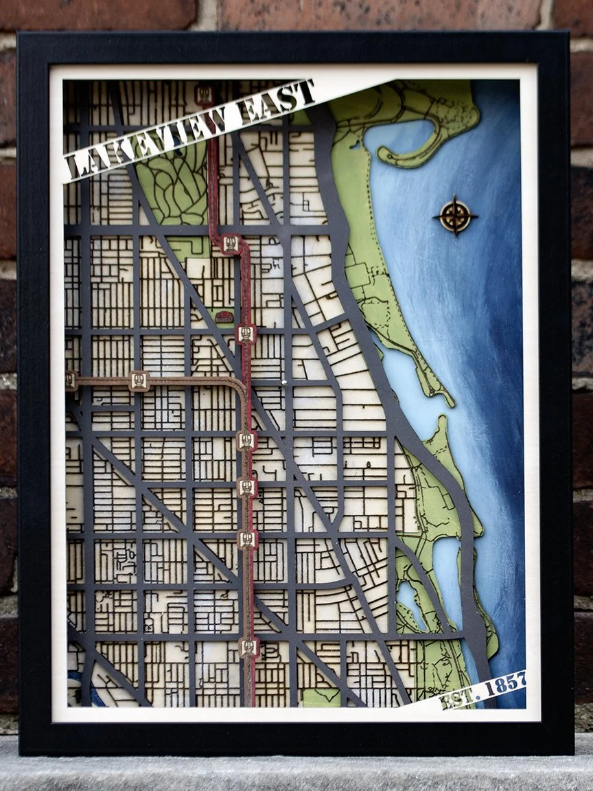
Layered 3D Wood Map of Lakeview East, Chicago | Customizable, Framed, and Ready to Hang | 12x16” | $199

Features Wrigley Field, the L Red & Brown Line Trains, Lake Michigan, neighborhood streets, and green spaces